
Any questions, email me at trmitchell31@yahoo.com
| |
| Photo Galleries |
| Video/Audio |
| PowerPoints |
| Places Visited |
| Home |
Created by Ted Mitchell
Summer 2008 Study Tour sponsored by the Korea Foundation
Alan Shawn Feinstein Middle School of Coventry
www.asfms.net
www.mitchellteachers.org
| South Korean Geography |
|
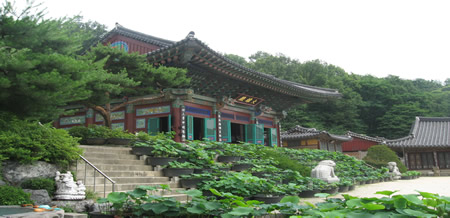
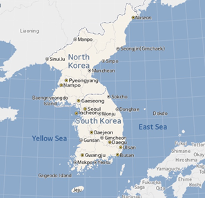
The Korean peninsula has rugged, mountainous terrain, with barely one-fifth of its surface in lowlands or plains. Few of the mountains are high compared to those of some other Asian countries, but they are so extensive that there are few places in South Korea where mountains cannot be seen.
Southward, the mountains continue in the Nangnim range, and then along the east coast of South Korea as the Taebaek Mountains. Another chain, the Sobaek Mountains, stretches across the peninsula to the southwest. The southern mountains are lower than those of the north, reaching about 6,000 feet (1,830 m) at their highest.
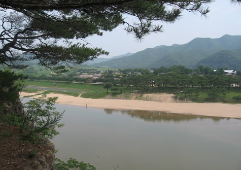
Lowlands are chiefly between the mountains and the coasts. Only a narrow coastal plain lies along the eastern shore; to the southeast, however, the plain widens and extends well inland along the Naktong River valley. The most extensive lowlands are in the west, stretching northward in a broad arc from Chonju to the North Korean border. The southern and western coasts are heavily indented by bays and dotted with islands. Some 50 miles (80 km) off the southern coast is the large island of Cheju, which is part of South Korea.
Rivers are generally short, winding, and fast-flowing. Most of them flow from the eastern mountains across the lowlands to the Yellow Sea. Among the larger rivers are the Han and the Kum. The southeast is drained by the Naktong River system, which has its outlet in the Korea Strait near Pusan. A number of rivers provide power to operate large hydroelectric installations.
There are sharp contrasts between the seasons, with cold winters and warm, humid summers. The climate is strongly affected by seasonal monsoons. In winter, cold dry air flows out of Siberia, dropping average temperatures over most of the peninsula to between 20° and 30° F. (-7° and -1° C.). Only in the extreme south do average temperatures stay above freezing. In summer, warm and moist southerly winds bring frequent rains and temperatures ranging from 70° to 80° F. (21° to 27° C.).
Precipitation averages 30 to 50 inches (760 to 1,270 mm) annually, except in the far north. There, as little as 20 inches (510 mm) is received each year. Typhoons occasionally move up from the South China Sea, bringing very heavy rains and high winds.
Evergreen forests of fir, larch, pine, and spruce are extensive in the higher areas. Forests of deciduous trees and pines prevail elsewhere, in the warmer areas. Overcutting and clearing for agricultural purposes have depleted many forests, causing serious soil erosion in some areas.
- From How Stuff Works| South Korea Physical Map | ||
 |
||